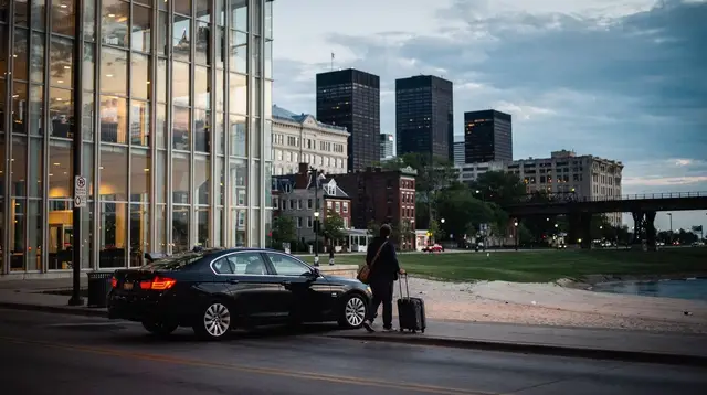
Getting around Chicago without a car
Do you need a car to visit Chicago?
No. Most visitors cover downtown, the North Side, and the lakefront using the L, buses, walking, and the occasional rideshare. A car mainly helps for suburbs or day trips outside the CTA and Metra network, like Starved Rock or Galena.
The case for skipping a rental car in Chicago
Renting a car in Chicago solves almost nothing for a typical visit and creates several problems: hourly or daily garage rates downtown, unfamiliar one-way streets in the Loop, and traffic on Lake Shore Drive at rush hour. The city’s core attractions sit in a compact band along the lake, connected by a transit system that residents use every day. Unless your plan includes several stops that fall outside the CTA and Metra network, a car is more often a cost and a headache than an advantage.
This guide is meant as an overview, not a deep dive into any single mode. The CTA’s elevated and subway network, known locally as the L, already has its own detailed guide at The CTA ‘L’ train guide to Chicago. What follows is how the pieces — the L, buses, walking, biking, and rideshares — fit together into a coherent way to move through the city, and when each one actually makes sense.
The L handles the long distances
For anything beyond a short walk, the L is the backbone of getting around Chicago. Eight color-coded lines run mostly on elevated track, with some subway sections downtown, operated by the CTA. Trains link the Loop to the North Side neighborhoods, the South Side, and both airports.
The detail worth remembering here, since it trips up a lot of visitors: only the Red Line and the Blue Line run 24 hours a day. Every other line, including the Brown, Green, Orange, Pink, Purple, and Yellow lines, stops overnight and resumes service in the morning. If your evening plans end late and your route home depends on one of those lines, check the schedule before you go out rather than after. Fares are paid with a Ventra card or the Ventra app, tapped at turnstiles on entry.
For the full rundown of lines, fares, and which stations serve which neighborhoods, see The CTA ‘L’ train guide to Chicago. This guide only needs you to know that the L is the default choice for medium and long trips across the city, and that timing matters more at night than during the day.
Buses fill in where the L doesn’t reach
The CTA bus network is denser than the L map and covers streets the trains never touch, including many east-west routes that link neighborhoods the L only connects indirectly. Buses use the same Ventra card or app as the L, so there’s no separate payment system to learn.
Buses are generally slower than the L because they share the street with traffic, and schedules are more exposed to congestion and weather. They’re most useful for short hops within a neighborhood, connections to an L station that isn’t within walking distance, or routes where no train line runs in a useful direction. If you’re relying on a single mode for a whole trip, the L is more predictable; buses are the flexible complement, not the main plan.
Walking covers the Loop and the lakefront neighborhoods
Within the Loop itself, walking is often the most efficient option. Millennium Park and Cloud Gate, the Art Institute of Chicago, the Chicago Riverwalk, and the base of the Willis Tower all sit within a 10-to-15-minute walk of each other. A self-guided loop walking tour is a reasonable way to string these stops together without touching transit at all for a morning or afternoon.
The same logic extends north into River North, Streeterville, and along the Magnificent Mile, where sidewalks are wide and blocks are walkable in normal weather. It breaks down in winter, when wind off the lake makes long walks unpleasant, and it breaks down over longer distances — walking from the Loop to Lincoln Park or Hyde Park is a multi-hour undertaking, not a stroll. Use walking for the compact, central stretches and switch to transit once a trip crosses more than a mile or two.
Biking the Lakefront Trail is its own category
The Lakefront Trail runs roughly 30 kilometers along Lake Michigan, from the North Side down past the Museum Campus and into the South Side. Divvy, the city’s bike-share system, has stations at regular intervals near the shoreline, and a ride along the trail is one of the better ways to see the skyline from the water side rather than the street side. There’s a dedicated Lakefront Trail biking guide if this is a priority for your trip.
Treat this as a scenic and recreational option more than a general commuting tool. The trail runs north-south along the water; it doesn’t help much for east-west trips into neighborhoods away from the lake, and most L and bus lines don’t parallel it closely enough to combine easily. If your goal is simply crossing the city, the L is faster. If your goal includes enjoying the lakefront itself, biking earns its place.
Rideshares and taxis for the gaps
Rideshare apps operate throughout Chicago and are a normal part of how residents fill the gaps transit leaves: a late night on a line that has stopped running, a trip with heavy luggage, bad weather, or a connection that would otherwise mean two transfers for a short distance. Traditional taxis are also available, especially downtown and near hotels, and can be hailed on the street in busier areas.
Neither replaces the CTA as a primary way to see the city — fares add up quickly compared to a Ventra tap — but both are worth having as a backup, particularly for the O’Hare or Midway connection late at night, or for reaching a restaurant or venue in a neighborhood with limited transit coverage after dark.
Metra, for trips into the suburbs
Metra is the commuter rail network linking Chicago to its suburbs, distinct from the CTA and running on a separate fare and schedule system. It matters less for a typical downtown-focused visit and more if your plans include suburban day trips, such as Oak Park or other stops along its lines. One practical note: Metra frequencies drop noticeably on weekends compared to weekdays, with fewer early and late trains, so check the timetable for your specific line before building a Saturday or Sunday plan around it.
Some neighborhoods take longer to reach — plan for it
Not every part of Chicago sits an equal distance from downtown. Hyde Park, home to the University of Chicago and the Museum of Science and Industry, is well south of the Loop, and a visit there is a longer outing than a quick trip to a North Side neighborhood. The same applies in the other direction to some of the farther North Side spots. None of this makes these places hard to reach — CTA buses and the Metra Electric line both serve Hyde Park — but it’s worth building extra time into your schedule rather than assuming every neighborhood is a short ride from your hotel. If you’re mapping out a full day that includes a farther-flung stop like this, treat the travel time as part of the day’s plan, not an afterthought.
Arriving from the airport is a separate question
Getting into the city from O’Hare or Midway is its own topic with its own considerations — which CTA line to take, how long it realistically takes with luggage, and when a taxi or rideshare makes more sense than the train. That’s covered in full at Getting from O’Hare to downtown Chicago: comparing your options, with airport-specific transfer notes also available for O’Hare and Midway separately. If you’re arriving with a lot of bags and don’t want to haul them around before check-in, the luggage storage guide is worth a look too.
Putting it together: a simple way to choose
A rough mental model works better than memorizing every rule: use walking for anything inside the Loop or a similarly compact area, use the L for medium and long trips across the city, use buses to fill gaps the L doesn’t cover, save biking for the lakefront itself rather than general transport, and keep rideshares in reserve for late nights, heavy luggage, or awkward connections. None of these choices requires a rental car, and combining them is exactly how most Chicago residents get through their own day.
| Mode | Best for | Watch out for |
|---|---|---|
| Walking | The Loop, Magnificent Mile, compact stretches | Distance, winter wind |
| The L | Medium and long cross-city trips | Only Red and Blue lines run 24 hours |
| CTA bus | Gaps the L doesn’t reach | Slower, exposed to street traffic |
| Divvy / Lakefront Trail | Scenic lakefront trips | Not a general east-west option |
| Rideshare / taxi | Late nights, luggage, awkward routes | Costs add up versus Ventra fares |
| Metra | Suburban day trips | Much lower frequency on weekends |
If you’d rather hand the logistics to someone else for a day, a scenic driving tour or a guided walking tour covers ground without you needing to plan the route yourself, and a timed-entry option like the Skydeck at the Willis Tower is a straightforward L or walk from most downtown hotels. For neighborhoods a bit further off the main routes, a guided street art tour or a seasonal walking tour can also take the route-planning off your hands, and a scenic driving tour is worth considering if you want to cover more ground in a single outing without navigating yourself.
For a fuller sense of how these pieces stack up over several days, a five-day car-free itinerary walks through a full trip built entirely on the modes above, and the hop-on hop-off bus is another option worth comparing if you want a single ticket that covers multiple stops. If you’re weighing a multi-attraction pass alongside your transport plan, the CityPASS and Explorer Pass comparison is a useful companion piece, and the broader transport category has more on getting around the city generally.
Getting around Chicago: quick answers
Do you need a car to visit Chicago?
No. Most visitors cover downtown, the North Side, and the lakefront using the L, buses, walking, and the occasional rideshare. A car mainly helps for suburbs or day trips outside the CTA and Metra network, like Starved Rock or Galena.
Can you see all of Chicago without a car?
You can see the vast majority of what visitors come for without one. The Loop, the Magnificent Mile, Lincoln Park, Hyde Park, and the lakefront are all reachable by the L, bus, or on foot. Day trips to places without rail access, like Starved Rock or Galena, are the exception.
Is the L safe and reliable enough to rely on for a whole trip?
Millions of residents use it daily, and it is a normal way to organize a Chicago trip. Keep in mind that only the Red Line and Blue Line run 24 hours a day; other lines stop overnight, which matters if you are planning a late return.
How do you pay for CTA buses and trains?
With a Ventra card, either the physical card or the app. It works across the L and CTA buses, and it can also be loaded for Metra in some cases. Tapping in at a turnstile or on a bus reader is all that’s required.
Is Hyde Park hard to reach without a car?
It’s doable by CTA bus or the Metra Electric line, but it sits well south of the Loop, so plan for a longer ride than a downtown-to-downtown trip. Build extra time into your schedule rather than treating it like a quick hop.
Should you walk or take transit in the Loop?
Walking works well within the Loop itself, since attractions like Millennium Park, the Riverwalk, and the Art Institute of Chicago sit close together. For anything beyond a 15-to-20-minute walk, the L or a bus is usually faster than covering the distance on foot.
Is biking the Lakefront Trail a realistic way to get around, not just sightsee?
For trips along the lake itself, yes, especially with Divvy bikes available at stations near the shoreline. It’s less practical as a general-purpose way to cross the city east-west, since most L and bus lines don’t parallel the trail.
When does it make sense to use a rideshare or taxi instead of transit?
Late at night on a line that doesn’t run 24 hours, when traveling with a lot of luggage, in bad weather, or for a short hop where transit connections are awkward. Rideshares are common in Chicago and fill the gaps transit leaves.
Do you need a car for the airport transfer?
No. Both O’Hare and Midway connect directly to the CTA, and getting from O’Hare to downtown Chicago has its own dedicated guide covering the Blue Line, taxis, and rideshare options in detail.
Getting around Chicago on GetYourGuide
Verified deep-linked GetYourGuide tours. Book through these links and we earn a small commission at no cost to you.
GetYourGuide does not provide a product photo for this activity — the image shows the meeting point, photographed by us.